
My Two Primary Sources
The first primary source I found was a picture of Washington D.C. This picture can be found on flickr.
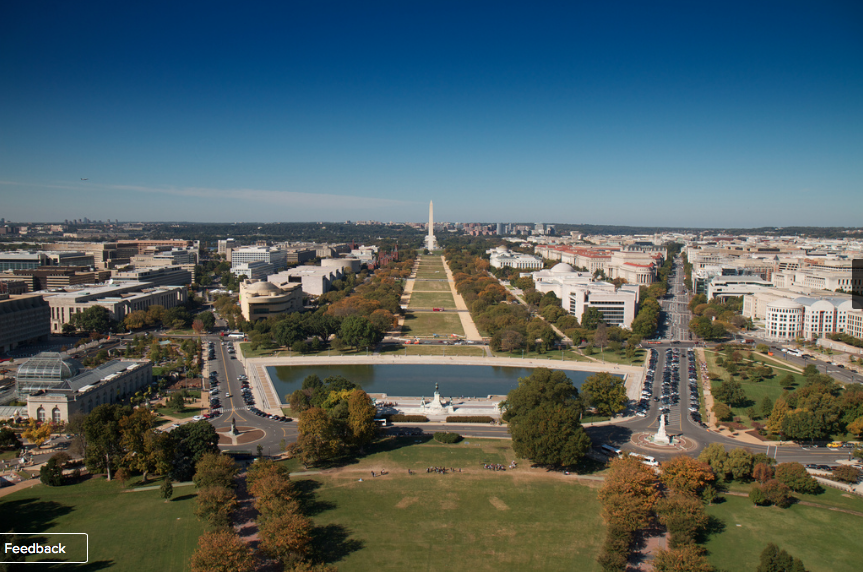
This photo is great because it shows the entire landscape of Washington D.C. You are able to see the amazing surroundings of Washington D.C, which, to me, is really interesting. The photographer of this photo is Rob Shenk, who seems to capture a lot of historical landsites. On his flicker page, he has numerous photos of pirate ships, old planes, lighthouses, and many other beautiful pictures. It seems as if Rob Shenk just wanted to simply capture the beauty of DC all in one photo. In the picture, the sun is shining and the sky is clear. This photo really makes me want to visit DC because of how beautifully captured it is. Additionally, this photo was taken in October of 2010. Therefore, it’s definitely recent and up to date. There was not anything important going on at the time of this photo, so it doesn’t correlate to any vital pieces of information. This photo is intended for anyone who was wondering what Washington DC may look like.
The next primary source I analyzed is a map that can be found here. It’s a map of Washington DC. This map is extremely out of date, considering it is dated to 1909. A lot has changed since then. There’s been wars, and many new presidents have been inducted. On the upper left hand side of the map is a list of all the presidential inaugurations. Roosevelt, being the last name mentioned. This map is over 100 years old! The contributor of this map is M.I. Weller, which I can’t seem to find any information on. Therefore, he may have been a reliable source back then, but currently he doesn’t seem like he has credentials. A good thing about this map is that it tells us what direction everything is in. For example, it shows us where NW, NE, SE, and SW are. That is an important piece to have included in a map!
Overall, I found that the photos are much more easier to work with. Not only do I like photography better, but it is also a better visual of the piece. Between maps and photographs, photographs capture all the landmarks whereas a map will just tell you where it’s located. Also, since the map was outdated, it was harder to work with and analyze.
1 Comment »
Filed under: Theory and Practice
February 12th, 2014 at 2:46 am
Elizabeth,
I love the enthusiasm with which you describe the photograph of DC, and you’ve done a really great job of describing the map. What is missing is a close reading analysis of these two sources. Let’s start with the map – you say it’s only good for providing physical locations, but maps are deceptively complicated, meaning they appear simple. Maps are not just markers of physical locations but are records of the way people saw the world at a certain time. What they chose to include in their maps, for example, tells us a lot about their world view and what they thought was important enough to record. You very adroitly picked up on a very unique and important part of this map – the list of presidential inaugurations. This is a very unique detail to include on the map, and it inspires a whole realm of questions, starting with the most simple one: why the heck is it there? What exactly was this map used for? When we begin to ask these questions, the map becomes a treasure trove of information and inquiry. The photograph is the same way. Sources are never what they first appear. This is why we must do close reading.
– Claire